Realizing that much of our iconic Southwestern landscape has been paved over, dug up or sucked dry, Bill Clinton, in the final days of his presidency, anointed a large unspoiled chunk of Arizona as the Sonoran Desert National Monument – half-million acres stretching south from Buckeye then east from Gila Bend along either side of I-8.
For these past three decades, in my constant shuttling back and forth between Yuma and Tucson, this 30-mile stretch has always been the highlight of the trip. On one end, the double ribbon of highway rises into the hills near the Sand Tank Mountains (whose distinctive pair of symmetrical peaks bears an official name that is both sexist and racist).

On the other end, it descends into the agricultural corridor around Casa Grande. There, to the south beyond the undeveloped interstate rest area, looms the Monument’s crown jewel – the sloping mound of Table Top Mountain.
Winter rains
The first time I climbed Table Top, some 15 years ago, I was invited along on an overnight jaunt with some long-time explorers of the area – a sweet couple, soon-to-be-retired science teachers, that I had recently met.
I caravanned over with one of their colleagues, an art educator whom I knew of as an ex-girlfriend of the ex-husband of an ex-girlfriend of mine. Here she was with a new guy, and she was making this hike at eight months pregnant – the adventurousness of which I would truly appreciate the next day on the trail.
Keeping in touch with the other vehicle via walkie-talkie, we finally turned south into the wilderness on the dirt track known as Vekol Road. Light rain had been falling throughout the overcast winter afternoon, and the mountain, now only a few miles ahead, was mostly hidden beneath a gray blanket of cloud.
We followed a side road to the east until it ended at the gap between two low hills, where we had our pick among the four cast-iron fire rings in the deserted campground. It was a sober bunch, and we turned in early. Anyway, tomorrow would be a long day.
Classic Sonora
We began the day, three hardy couples and myself, by snaking among the trailhead posts that limited access to hikers. Up ahead, the heavy clouds now hung well above the summit, but they promised to get us wet at some point.

The first half-mile or so follows the old Jeep track until it reaches another cluster of posts – remnants of the original trailhead. To our left was the volcanic cone of Black Mountain, accessible from a couple of other trailheads farther west.
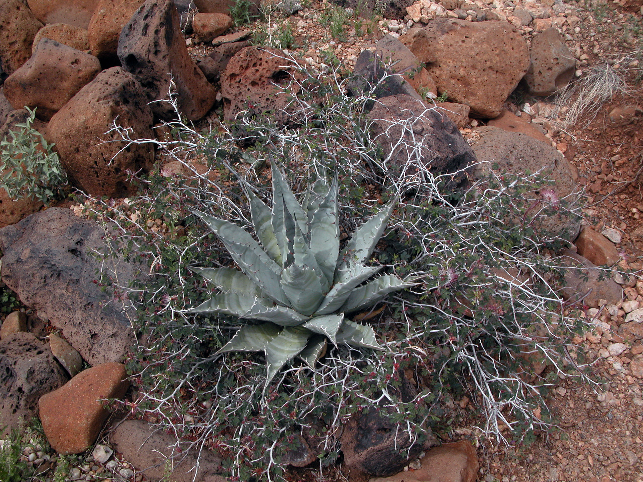
For about two miles, the trail gains only about 500 feet, dipping and rising across a badland of impressive washes. Sloping into the distance to the south and east was quintessential Sonoran Desert terrain – a veritable forest of healthy saguaro cacti, paloverde trees and ocotillos shrubs. The ground was carpeted with bright-green ground cover, characteristic of only the wettest winters.
The terrain grew more rugged, and finally the trail hit the foot of the mountain, zagged hard to the right traversing a deep arroyo, and then started sloping upward in earnest.
Walking in a fog
My memory of the next couple hours is of switching back and forth, back and forth along the well-worn trail up that steep western slope. Our movements were hampered by our rain ponchos, which were dripping in the palpable shifting mist, and our hiking boots were heavy with mud. Fumbling with a camera in those conditions was prohibitively inconvenient.

Maintaining a steady pace on those endless switchbacks – virtually blind behind our fogged glasses, the only sounds the rustling of plastic around our heads – was an exercise in sense deprivation.
At last the trail hit a drop-off at the northern face of the mountain and took what promised to be a final hard right along the ridge. The destination remained elusive, though, hidden somewhere up ahead in the clouds.
Shelter from the gale
Our group had become increasingly separated along the steep trail, spread out according to the conditioning and determination of the individual, and I found myself alone in this forlorn spot. The wind at this elevation had turned quite cold and was howling among the boulders and shrubs, and I realized I might get some relief behind the line of rocks that was nearly hidden in the mist a few feet to the left.
I slipped through an opening in the natural rampart, crawled down about four feet, and found myself perfectly sheltered from the wind. (I later read an account of this hike claiming that this actually is a constructed wall, but for what possible purpose in such a desolate place?)
Eventually I heard voices, and I looked over the wall to see my friends the science teachers, silhouetted vaguely in the haze, looking like elfin pilgrims in a medieval epic. I had to raise my voice so they could hear me over the roaring wind, and even then they were stumped as to where it was coming from.
A surreal landscape
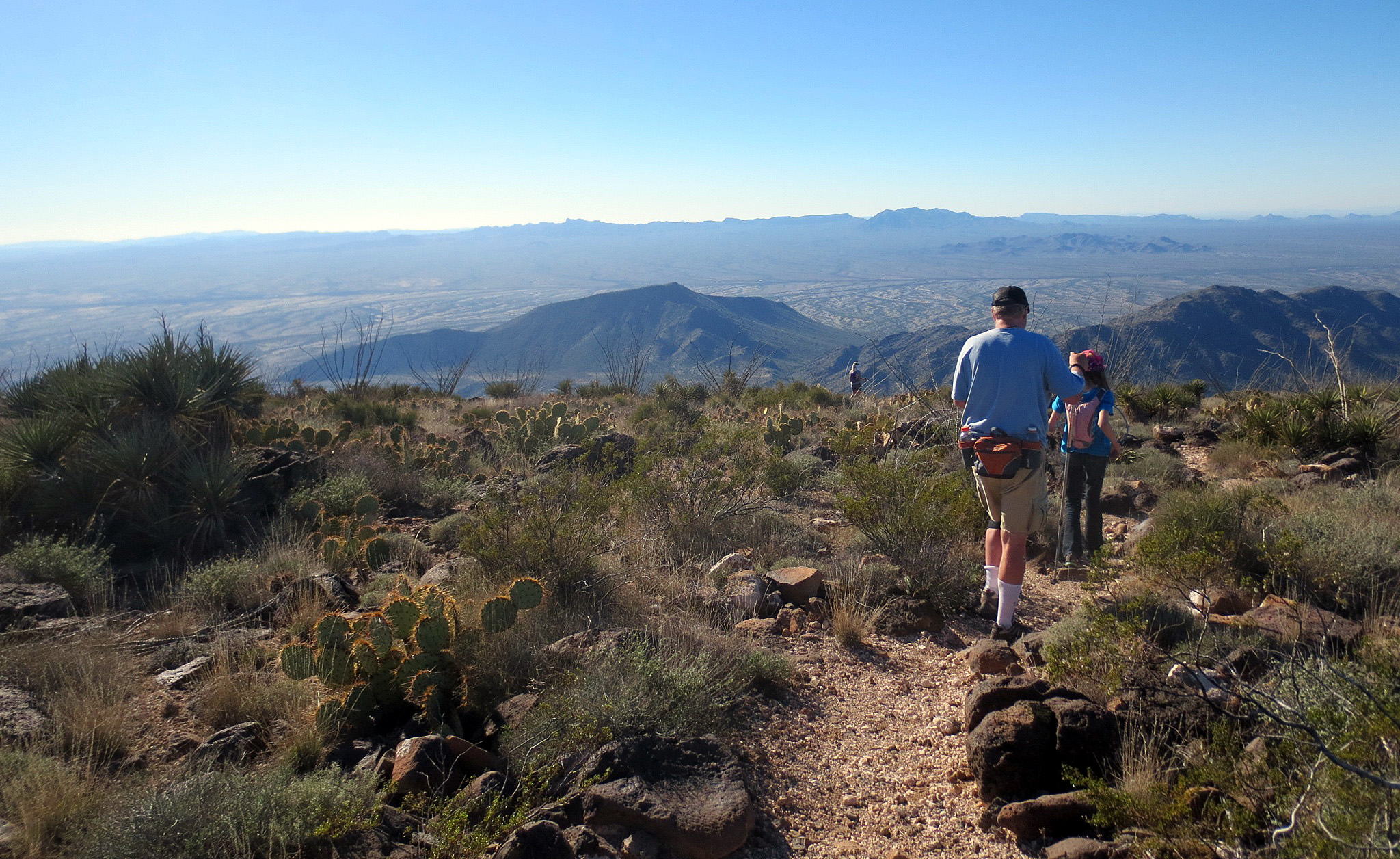
After we warmed up a bit and refueled on a shared smorgasbord of trail snacks, we crawled out into the weather and headed for the top. Finally, the ground leveled off, and there we found the pregnant art teacher, who had outpaced everyone – mystical against the fog, like some Thomas Hardy heroine standing transfixed upon the moor.
What appears from the desert in every direction to be a flat mesa actually is a horseshoe-shaped ridge, sloping gently toward a central drainage that leads off the eastern edge of the mountain. At the time, we could see only a couple of hundred yards into the mist, which wafted over a meadow of stunted shrubs – a completely different ecosystem than the one we had left behind on the desert floor.
We couldn’t stay long in that weather, but I realized that I would have to repeat this feat on a more typical Arizona day in order to gain the spectacular views that this vantage had to offer.
Encore
That sunny day had to wait about a dozen years. This time I was with family, including my youngest daughter, my oldest daughter, and her two kids.
Indeed, the view from the top was breathtaking, unhindered in every direction all the way to the far-distant ranges. The air was pure – though the green-and-brown patchwork of fields down below was shrouded in places by chemical vapor and dust.
At the summit, marked by a wooden post, we ate our lunch and contemplated our further hiking options – including the long curving trail to the opposite ridge, which actually is slightly higher. Before we could commit to a plan, though, my grandson took off down the mountain on one of his famous hyperactive flights.
Now, I have observed that my daughter doesn’t worry as much about her offspring as, for example, I did about her as a kid. On this occasion, the trailhead being four miles away, I imagined every possible cause of death – heatstroke (he hadn’t taken any water), mountain lions (this was after all a remote wilderness), kidnappers (this was in fact a trafficking corridor), a simple fall on the loose rocks. And that’s not to mention getting lost with no time to figure out the mistake before the sun went down. At was at least too early in the season for rattlers – probably.
A border ballet
It was indeed after sundown when we set off on the hour-long drive back up Vekol Road to where we would go our separate ways at I-8, to Tucson and Yuma. But by now this valley, which in the daytime appears deserted, had come alive in the dark with a grim cat-and-mouse contest.
Border Patrol vehicles zipped by us in both directions, sometimes veering onto or off of the countless side roads. Meanwhile, there seemed to be a whole fleet of Rhinos tearing around out in the desert, their headlights winking on and off among the creosote bushes.
Clearly, the smugglers’ strategy was to overwhelm the opposition with sheer numbers. No doubt most of the ATVs were mere decoys – “No law against off-roading on public lands, eh amigo?” – and evidently enough of the contraband would come out the other end to make the whole operation worthwhile.
Oddly, the BP never seemed to take a second look at either of our vehicles. (Some campers have reported being grilled at length and warned away from the area, but maybe that was before the smuggling industry became so high-tech.)
We certainly had to wonder: If it’s like this way up here, 80 miles from the border, what must they be going through on the vast Indian reservation in between?
The latest scheme
Surely the 30-mile segment of I-8 that bisects the Sonoran Desert National Monument – stretching west from the base of Tabletop near the end of Maricopa Road to a few miles shy of Gila Bend – is among the most beautiful in the entire Interstate system. Sadly, once development has expanded outward as far as it can go, we’re obligated to look for ways to fill it in, and this corridor could be among the next casualties of that ideology.
Perhaps aptly, the plot to add a new freeway, I-11, has its origins in the 9/11 attack. At that time, we were suddenly much more concerned about key pieces of infrastructure, and a short bypass around Hoover Dam was commissioned to the tune of $250 million.
Next step? Why not an actual interstate between Las Vegas and Phoenix (in keeping with the modern concept of “megapolitan areas” – the third corner being L.A.). And why stop there? Why not go on past Tucson all the way to the Mexican border?
Such processes have a life of their own, and a couple of months ago, the highway agencies released the results of their years-long study, narrowing down the feasible routes. One of the surviving possibilities is to merge the new highway with I-8 between Casa Grande and Gila Bend. Presumably, that means beefing up the stretch through the Sonoran Desert Monument, meaning years of heavy construction in the midst of that unspoiled area.
Epitaph
At the moment, though, the preferred path for the southern half of I-11 bypasses Tucson up the Avra Valley, runs parallel to I-10 along the Santa Cruz River floodplain south of Picacho Peak, jogs north around Casa Grande, follows the northern edge of the Sonoran Desert National Monument, and cuts north of the Buckeye Hills before finally crossing I-10 on its way to Wickenburg.

No environmental impact statement could ever account for the diverse species to be affected by such a project, and no monetary value could be placed on the visual alterations to the landscape. Among the sensitive areas to be permanently diminished, however, are the Tucson Mountains, the Saguaro National Monument, the Arizona-Sonora Desert Museum, Picacho Peak State Park, the Sonoran Desert National Monument (including Tabletop Mountain), Estrella Mountain, the Buckeye Hills State Recreation Area – including its priceless archeological sites.
It might be one thing if we could seriously argue that such a gargantuan undertaking is really necessary, but the favored route is barely different from the existing I-19/I-10 network. Why not just widen that?
Much more to the point, though, how can we possibly justify continuing the obsolete transportation paradigm, tied as it is to planet-killing fossil fuels? Where in the literal Hell is this madness going to end?

Such places make me dream… I live in soggy Britain, but I love cacti and the desert. The amount of wildlife in such a (too me) alien place is extraordinary. One day, I’ll travel there…
LikeLiked by 1 person
Thanks for your note. The biological diversity here really is staggering. Also really fond of your part of the world!
LikeLiked by 1 person