I’m a greenhorn who never crossed the Continental Divide until well into his 30s, so I still see Arizona as a vast patchwork of hidden gems waiting to be discovered.
One of those gems is Aravaipa Creek, a tight drainage of three mountain ranges that quickly funnels through the riparian paradise of Aravaipa Canyon Wilderness and dumps into the San Pedro, which dumps into the Gila, which dumps into the Colorado, and so on to the Sea of Cortez. It takes hours to get into this remote pocket from any populated area even by car, and the few actual inhabitants are scattered widely among the many side canyons that snake down from both sides toward the winding graded road.
On one of our rare excursions out that way, we followed one of these side canyons to the foot of the mountains that stretch along the southwest margin of the valley, the Galiuros. At the end of the road was a trailhead that led across some pastureland and up a steep groove in the side of a mountain, and a National Forest sign that mentioned, among other things, a variety of large mammals. The view was so stunning, we just had to camp there, and we resolved to explore that wilderness the first chance we got.

Taking the plunge
When we finally got around to looking into an extended visit, we discovered that the Galiuros are actually shaped something like a long H, with a pair of inner drainages sloping in opposite directions away from a central high point – one to the north, the other to the south.
We also discovered that the southern drainage, called Redfield Canyon, was likely to have a running creek during the winter months. Since water is always a high priority on a multi-day backpacking expedition, we chose that side.
A crow would have to fly only about 30 miles from the eastern edge of Tucson to a perch overlooking Redfield Canyon, but for us ground-bound species the trip is considerably less direct. The drive east around the big bend of I-10 to Wilcox is about 90 miles, and then the route doubles back straight west along what is somewhat pompously named Airport Road.
Beyond the impressive array of mostly greenhouse agriculture, the pavement disappears, and a graded road heads out into the chaparral until it splits onto an even more primitive tract called Muleshoe Road, which offers a long look at the beautiful Winchester Mountains to the northeast.
A long, winding road
Finally, the road passes Hooker’s Hot Springs, which has been taken over by the Arizona Nature Conservancy. There, a well-maintained cluster of buildings features a gift shop and reservation-only accommodations for dedicated nature lovers.
In stark contrast to this oasis of majestic cottonwoods lies the Muleshoe Wilderness Management Area, a badland of rocky hillsides and abrupt gullies. The rugged road that winds for a dozen miles toward the wooded mountains on the other side is a journey unto itself.
The starkness was offset, though, by the brilliant patches of yellow and orange that shifted in and out of view among the outcroppings. It had been one of those exceptional rainy winters, and whole hillsides were abloom with fields of desert daisies and Mexican poppies.
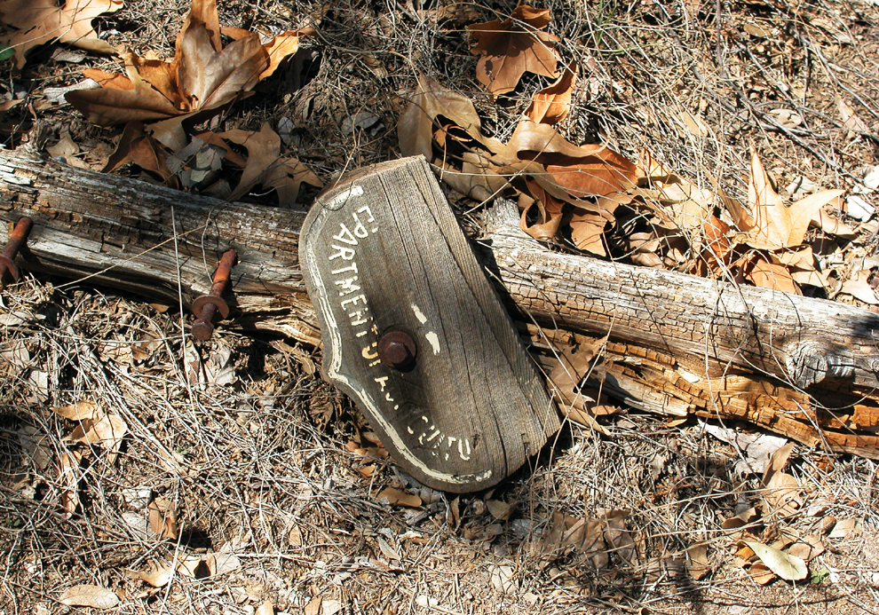
At the end of the road sits a cabin – more of a meeting lodge – along with the usual information boards outlining etiquette, risks, and so on. In the dirt parking lot, one other vehicle sat in the mottled shade of the late sun, so we weren’t the only obsessive fresh-air freaks. I secured the Jeep and disconnected the battery (a dead vehicle would be a distinct buzz-kill way out here). Then we strapped on our matching borrowed backpacks and headed up the trail.
Leaving humanity behind
The creek was flowing strongly around the tail end of the range, a truly magical sight in this part of the world. We had to hack our way through the brush that had grown up between seasons, the various add-ons to our bulky packs catching on every branch.
Right away, I lost the mud-basket on one of my borrowed poles by wedging it between some river rocks. This would be a significant handicap to hiking over the next two and a half days, and I resolved to buy a high-end pair first thing, assuming I survived.
The sun was down by the time we turned up into the canyon proper. Presently, we stumbled upon a couple of guys in their thirties, obviously the owners of the other vehicle.
They were pitching their tent for one more night in the out-of-doors, probably in part to finish off whatever was left in their whisky flasks. No doubt starving for company after several days alone together, they seemed keen for us to join the party. But we needed to get as far as we could before dark.
When we’d had enough hiking for the day, we just dropped anchor in the middle of the trail. There, beneath the dense trees along the creek, the accumulation of leaves was so thick we didn’t even need to use our sleeping pads.
Cold water, cold air
The hike up the creek bed was an exercise in switching back and forth across the rocky stream. Thankfully, we had thought to buy open water shoes for the occasion. This was also our first experience with filtering water in the wilderness, and during our frequent breaks we were mainly occupied with our awkward personal hand pumps.
For the most part, this lower reach of the canyon was a wide rocky corridor, flanked on both sides by low hills on either sides and punctuated by flat mesquite hammocks that were carpeted in seasonal grass. Campfire rings of various sizes indicated the popular spots for weekend warriors during hunting season, and perhaps the occasional Boy Scout troop.
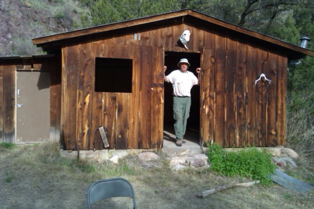

Our destination for the day was a cabin about six miles in, where we blissfully offloaded our packs. A few yards from the front door, the creek was wide and deep enough to qualify as a bona fide swimming hole. We each took a brief turn in the icy water and then savored the last of the day’s heat while the sun slipped behind the western ridge.
We were thankful for the pair of canvas cots inside the cabin, as they saved us setting up our tent. But, suspended above the concrete floor, we shivered throughout the night as the cold wind that slid down the valley whistled through the ample gaps in the walls. I’m not sure we ever fully fell asleep.
Daytripping
We were hoping to make it as far as the high point separating the range’s north and south drainages, and the only rational plan for the day was to go out from the cabin and back with only day bags. Confident that we were the only ones in this half of the wilderness, we hung our backpacks on nails in the side room and set off traveling light.
From the cabin, the trail led away from the stream, over rolling hills of tall grass. From this higher vantage, we got a good look at Sunset and Bassett peaks, the more wooded points along the eastern edge of the range, and we speculated on where some of the side trails might lead into the valley.

Eventually, we dropped back down to the streambed at a place where several steep draws wound down out of the hills and converged at a broad, open grove. Although the day had so far been overcast, it was suddenly sunny and warm.
We were both light-headed with exertion and lack of sleep, and we found ourselves immobile in the lazy shade. When we woke up some time later, we knew it was unrealistic to go any further and, with a touch of post-nap sadness, we started back.
Beyond the limit
Back at the cabin, we took a jolting dip in the swimming hole and reluctantly shouldered our packs. Now began the Zen of crossing and re-crossing the stream, of pushing on a little longer than preferable between snack breaks, of pumping water through the stiff filters until our arms ached, of hefting our burdens for another haul, of obsessively adjusting the hip and shoulder and chest straps for the best possible weight balance…
We had a particular campsite in mind, a soft beach with an intact fire ring. A dozen times, we were sure it would be just around the next bend, but somehow the anticipated spot always turned out to be yet another grove that we had forgotten having passed through.
This was one of the very few times I can remember thinking I couldn’t take another step, and I was ready to sit down and curl up in the creek bed on top of my pack. I was compelled to keep moving, though, because Lori had gone on out of sight up ahead in pursuit of the prize.
Just when I knew I was definitely done, I heard her call that we had finally made it. I don’t recall that we set up the tent that night.

In search of the burning bush
Up to this point in our explorations of the Arizona desert, our method had generally been to Jeep out to some remote spot and then day-hike from there. After this, though, we were inspired to buy our own personalized packs in order to stray even farther from the madding crowd.
It’s hard to argue with someone who questions the sanity of adding 30 pounds to the frail human frame and traipsing off where there are no comforts, no emergency help and, in this case, no cell service. On the other hand, that skeptic may never know the satisfaction of surviving such a test.
More importantly, if we spend our whole lives cowering in the protective cocoon of our conveniences, if we never let ourselves experience the vastness and the power of nature, then we might never be inspired to defend it. Some of the greatest insights come from wandering alone in the wilderness, and we need them now more than ever.

Well, if as Camus demands, we must imagine Sisyphus happy, I see no problem in your delights and reflections.
LikeLiked by 1 person