Nothing like a little comedy to fill a long drive.
My buddy Hanna and I are headed for two days in the remote wilderness of Signal Peak, and she’s fiddling with her 40-gigabyte iPod, one of those music gadgets that runs off the FM radio. She’s been struggling with it for miles along Hwy. 95 – past the YPG Howitzers, past the white surveillance balloon, past the Border Patrol checkpoint – as if we could hear anything over the road noise in my old jeep.
Once we top the pass at the west end of the Castle Dome range, we lose our radio signal altogether. Out here in open desert I’m not getting a cell phone signal either. As I turn right onto the washboard known as Palm Canyon Road, 60 miles north of Yuma, I wonder about the wisdom of disappearing into that looming mountain in a vehicle with 215,000 miles under its belts. Not to worry, Hannah’s cell works off the satellites.
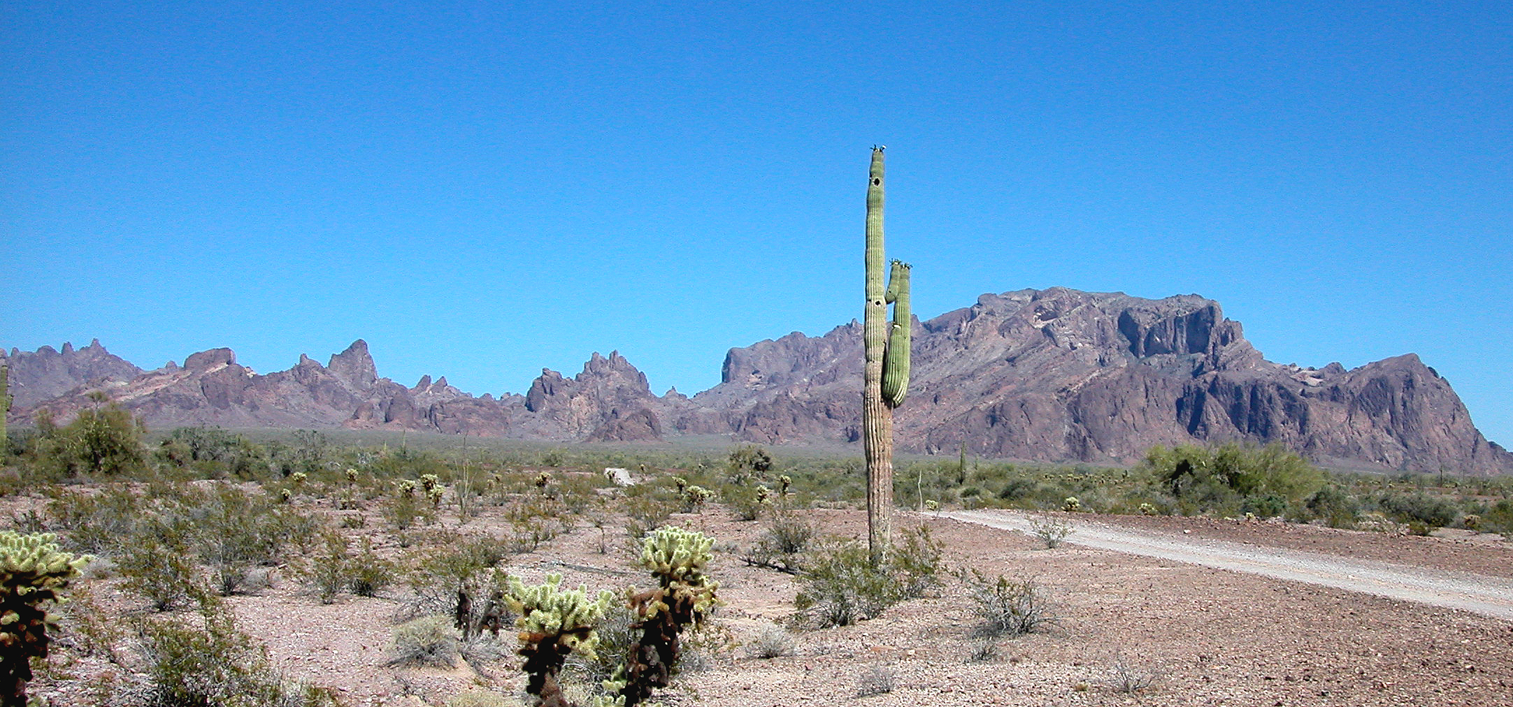
Just inside the boundary of the Kofa National Wildlife Refuge we bear left, and here the road actually is better except for an occasional dip into a sandy wash. After winding for five miles toward a saw-toothed row of peaks, we pass the mouth of Four Palms Canyon with its last-chance parking circle for the 4-wheel-drive deprived, and we settle into the dry gravel bed of Kofa Queen Canyon.
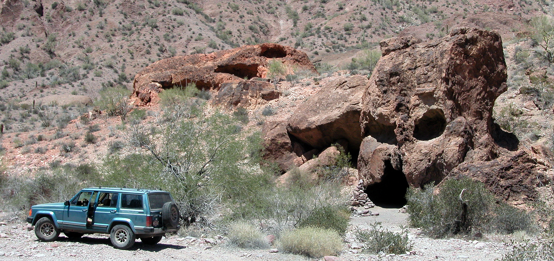
For the next three miles we creep along between impressive hoodoos, including the lifelike monolith that stands guard over Skull Rock (the best refuge around from winter rains and summer heat), until we finally pull off to the right into the narrow mouth of Ten Ewe Canyon.
We had wanted to check out Kofa Queen Mine a few miles farther on, but it’s already after 4 p.m. It being late spring and already hot, we actually planned it this way – climbing in late afternoon, with the north slope in shadow. But we’re not sure how long the ascent will take; we still might be rolling out our pads on a ledge somewhere short of the top.
A steady pull
We kill another half hour pondering the necessary provisions, then heft our frame packs and start in. Each choosing our own path among the interweaving streambeds, we bob in and out of sight of each other through the paloverde and giant creosote.
After crossing about half a mile of this basically level but rugged ground, I scramble up to a ridge, where I look over to see Hanna picking her way up a more gentle slope. Having been here before, she knew when to start watching for the regularly spaced rock cairns marking the trail.
To my right is a wide drainage. The sheer cliff on the other side is bisected by a light stain leading down from a notch that drains all of Indian Canyon above it. Hannah has come over to my ridge to join me, knowing I might be tempted to head down that way. The drainage leads up to a box canyon, she says, she made that mistake last time.
The proper trail is over to the left where she was, following a long rock wall. On our unmarked route up the ridge, we have to navigate hand over hand, which looks especially hard for her in the long hiking skirt she fashioned herself from a pair of thrift-store nylon shorts. In one of only two hairy moments of the day, she can’t make it over a boulder, and I try to pull her over with the end of my walking stick. Fortunately, it isn’t supporting her weight when the strap breaks.
About an hour into the climb we reach the first saddle, where she spent a cold night back in February in a dense fog. Today there is nothing to inhibit the view: far below us the shadow of the mountain has not yet swallowed the Jeep, a blue speck where Indian Canyon empties into Kofa Queen.
Catching our breath over a snack of sardines and cheese, we decide that we’re spending most of our energy on carrying the water. So we stash a gallon, still mostly frozen, where the sun won’t find it before tomorrow afternoon.
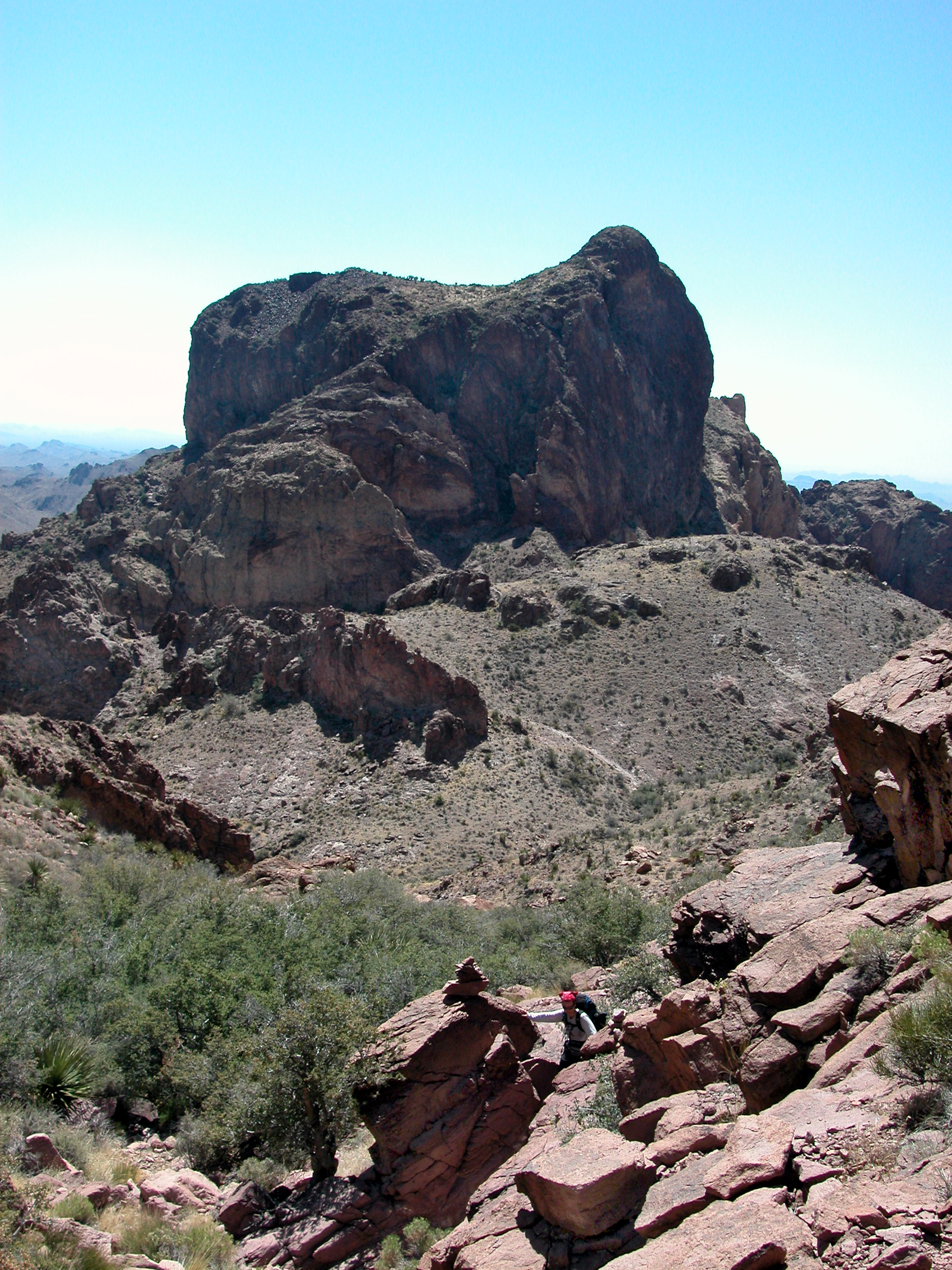
Ten Ewe Mountain, another hiking favorite, looms to our left – a massive dome only a few hundred feet lower than Signal Peak itself. We get sidetracked in that direction on some of the crisscrossing bighorn trails and have to scramble down the loose slopes to get back over to the Indian Canyon wash bed, leading up to the right.
I cross the bed and try to take the path less traveled on the right-hand side, but I end up wrestling my way through a thorny thicket to get back to the trail. My advice: follow the cairns religiously.
A starry, starry night
Soon the sun is setting, igniting a halo above the red canyon walls to the right. Back to the east, one pinnacle – built like a brick outhouse and bearing a similar name – glows like a hot iron pillar among the darkening hills.
With little daylight left to spot the cairns, we keep our heads down, hiking efficiently. Eventually, between the altitude, our fatigue and the waning light, we’re having trouble gauging the angle of the smooth bedrock. At one point I stray to visit a cave, a tempting shelter except for the prospect of unhealthy rat dropping. But to continue upward from there I’ll have to cling to a steep chute; Hannah convinces me I’ll never make it with my pack.
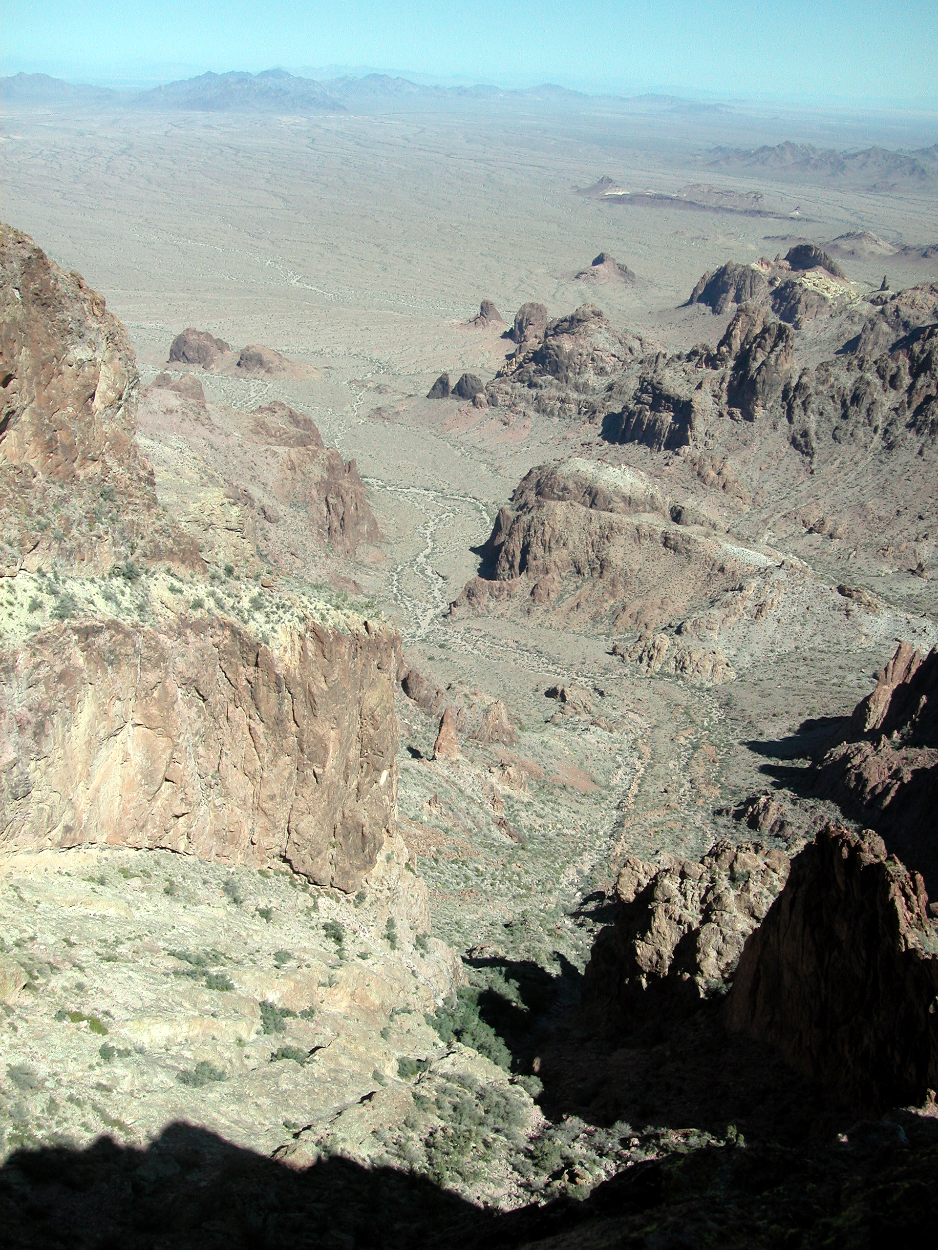
Suddenly, the wash flattens out into a broad basin. We drop our gear and jog the last 50 yards up to the jagged ridge silhouetted against the western glow. Over the low rampart is the sheerest vertical drop I’ve ever seen – at least 2000 feet into the abyss of Four Palms Canyon.
The whole western face of the Kofa range seems to drop straight to the desert floor, which stretches for miles, broken only by the dotted line of far-flung headlights out on U.S. 95. The sun is down, but far in the distance, beyond the first line of mountains, the last gold reflects off an elbow of the Colorado River where it runs through the flat fields below Blythe. Clusters of lights show the location of the farming hamlets and of facilities scattered across Yuma Proving Ground far to the southwest.
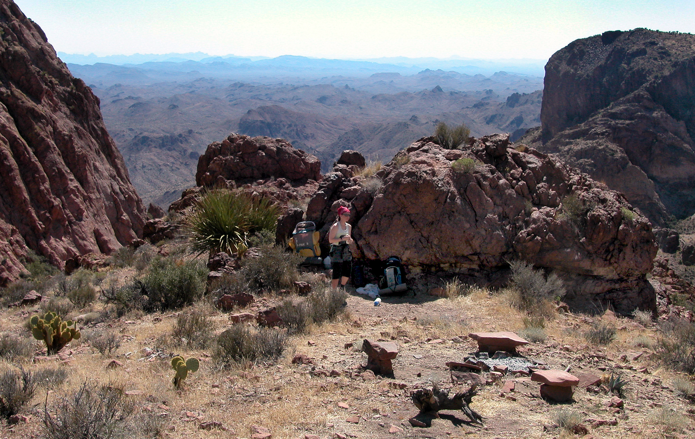
Escorted in the twilight by curious bats, we make our way back to our gear among the ghostly skeletons of scrub oak. There’s one place flat and clear enough for sleeping, tight up against an outcropping at the head of the canyon we climbed. Someone has even fashioned a sitting circle of stone benches. Exhilarated by the exercise and the surroundings, we stay up too late over a low fire, debating the state of the world from our lofty perspective.
I have never seen as many stars as I do tonight above this sheltered basin. There is no wind inside this bowl of peaks, with our council rock blocking the only open side. In the morning, though, Hanna says she was shivering with only a sheet. Not your typical night in late May.
King OF (Southwestern) Arizona
After a breakfast of tea and trail bars, we angle up the slope to the left for the final leg.
The summit itself is kind of unimpressive considering the surroundings. There actually are two mounds just a few feet different in elevation. The second one, to the southeast, has the geological survey marker and the register – a dull table for recording basic information, not the traditional notebook type on which I have read so much poetic narrative.

And what could be more awe-inspiring than to look down, for a hundred miles in every direction, onto the endless desert that was sidestepped even by the greatest early explorers? The horizon to the north is a line of mountains enclosing the snowbird winter sanctuary of Quartzsite and the rockhound’s paradise of Crystal Hill. Closer in, fanning out from the Kofas, lies a field of rounded peaks. With my binoculars, I spot the valleys where I visited Tunnel Spring and De La Osa Well one freezing Easter.
To the west and parallel to the river valley is the pale 40-mile gash of Algodones Sand Dunes, and above that the faint outline of the California coastal range, losing itself in the smog somewhere down in the Baja.
To the south is the Castle Dome range, its majestic namesake plug looking kind of puny from up here, a thousand feet higher. In between the two ranges is the broad expanse of King Valley, parched a light brown in this extended drought, its faint single road disappearing into the haze in the direction of Wellton.
And to the east the spiny body of the Kofas trails away from this massive head where I stand. In a notch about ten miles down, sunlight glints off the metal mining buildings of the old King of Arizona – the range’s new eponym since society ladies objected to the original obscene designation.
From the epicenter of this black-and-tan panorama, we send our cell-phone signals back to civilization.
All downhill
If the intrepid outdoorsman can tear his eyes from the vista, there’s actually a lot of territory to explore on top – unlike on Castle Dome, basically just a windswept outcropping. Here a ridge runs south from the peak for maybe half a mile, offering a varied view of the dramatic canyons draining the western face.
A couple of alternate routes up the mountain are worth scouting. There’s supposed to be a way up through Palm Canyon, famous as the last haven for the Arizona palm, a holdout from wetter eras. When I try that route, I’ll bring a rock-climbing expert. Even now I’m tempted to try exploring the long way, which descends east from the top over a series of terraces and ends up back in Ten Ewe Canyon.
But at 10 a.m. it’s already getting hot. Time to erase all signs of our campsite, transfer as much water as possible from our drinking bladders into our stomachs and look around fondly one more time.
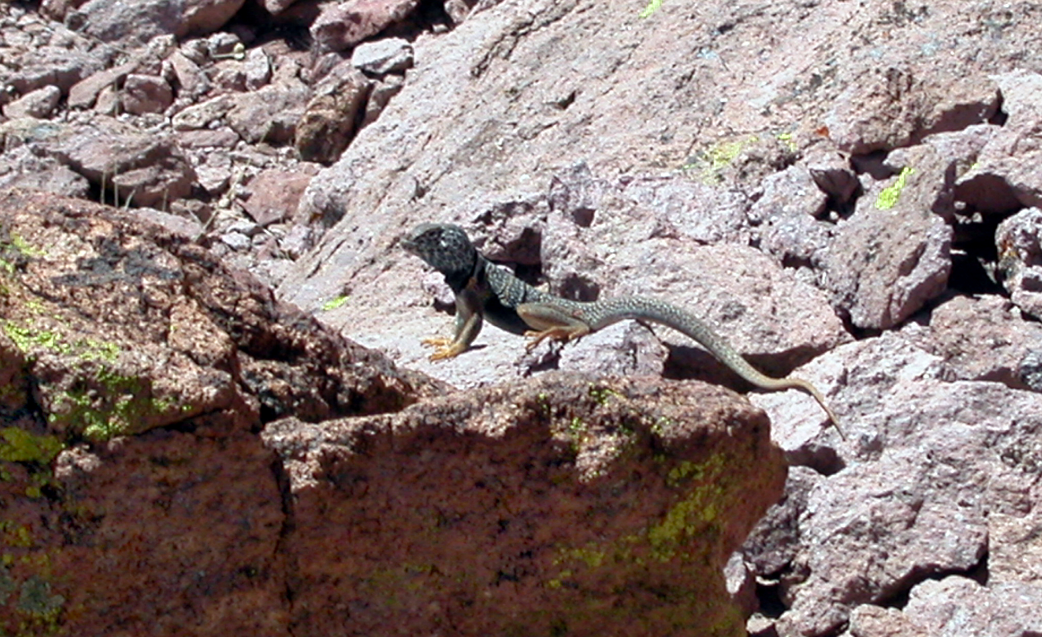
Though this is the main refuge in the country for the repopulation of bighorn sheep, estimated at about 1,000 head, we’ve somehow missed them this time. We do spend a few minutes sweet-talking an antisocial desert iguana we met on the same smooth waterfall area where I almost went airborne yesterday.
For me, it’s always harder going down. With my longer legs, I lead on the climb. But, being closer to the ground – on the low end of the 5-foot range – Hannah paces me on the descent, her red kerchief always bobbing somewhere beyond the next boulder.
I don’t remember the footing being this slippery or the dirt this loose. My thighs and my feet are complaining. (Hannah says that sandals are the secret of saving your toenails, but I’m skeptical.) I distract myself with trying to scout a way up Ten Ewe Mountain, which is in view till about halfway down. The rocky washes of the lower drainage are especially endless . . .
We had planned, on reaching the Jeep, to cook brunch on the Coleman stove and mediate on the last of our complete solitude. But it’s afternoon, and the temperature on the desert floor is much higher than on the mountain.
That’s all right: even the Yuma summer will pass, but this mountain isn’t going anywhere.

Enjoy reading about your climb and photos. As one who doesn’t do heights. I need to enjoy thru others adventures.
LikeLiked by 1 person
Thanks for your note. In this cover photo, there’s a natural rampart in the front face of the mountain, and the other side is a sheer drop of about 2,000 ft. It is amazing to see.
LikeLike