As much as I have snooped around the various crags and crannies of the Sonoran Desert, a gaping gap in my experience has always been the bioregion’s namesake state in Northern Mexico.
I’ve crossed over countless times into the very northwest corner – San Luis, R.C., the Pinacates, El Golfo, Puerto Peñasco. And I cut through the backcountry between Lukeville and Hermosillo half a lifetime ago on my first trip across the Continental Divide, chaperoning my brother on one of his many quests to hook up with some girl he’d met that summer down in the interior. (From what I’ve heard since then, we were lucky to make it through there alive, that being a major drug-running corridor during the mid-‘80s.)
But the only time I’ve traveled through the area south of Hermosillo was a quarter-century ago on a lumbering day-and-a-half train ride between Nogales and Guadalajara, a service that has since been phased out due to improvements to the toll road along the same route.

Over the years, I started hearing mention of a town at the southern tip of Sonora, a well-preserved gem with a starring role in the history of northern New Spain. In some earlier generation of scientific theory, the surrounding ecology was classified as the tailing edge of the Sonoran Desert. More recently it has been tagged with the curious label of “tropical deciduous forest,” a special transition zone between the North American deserts and the Mesoamerican tropics.
Exercise increased caution
Last winter, I had a two-week window between Christmas and my reunion with the time clock, so I figured I should at least consider Álamos among my options for exotic destinations.
Since my first forays into Mexico back in ’87, I have generally felt safer there than in my own country. But with some of the developments of recent years – the stiffening of U.S. immigration practices, the discovery of mass graves in previously tranquil border towns, the ambush of Mormon expats by cartel militias – I thought I’d ask around before planning ambitious travel.
At the moment, the State Department travel advisory for Mexico was at a Level 2 – i.e., Exercise Increased Caution. “Violent crime…is widespread,” the web-site entry began, adding that “U.S. government employees may not drive from the U.S.-Mexico border to or from the interior parts of Mexico,” one of only three exceptions being “daytime travel…between Nogales and Hermosillo on Mexican Federal Highway 15D.” They were in fact being told to reconsider travel to the state of Sonora, and they could not travel at all to Sinaloa, situated only a few miles south of Álamos.

A few random queries to the management of Álamos various lodgings did not turn up the same level of concern, however, so we began our characteristic spontaneous preparations.
Rites of passage
Google Maps estimated the drive from Tucson to Álamos at 9 hours, under ideal conditions. We figured it more like 12, though, accounting for soggy weather, a few driving breaks, an hour or so for an interlude to buy tourist visas and an auto permit, plus the usual certainty of unforeseeable happenstance.
In the Tucson dawn, the surrounding mountains were shrouded by impenetrable clouds. Once outside the city, though, the majestic Santa Ritas presented themselves with their dusting of snow, deposited overnight by the intermittent waves of a northwester down to the level of about 4,000 feet.
I don’t remember the corridor to Nogales as appearing transcendent, but it did on that day, lush in the middle of a wet winter, the gnarled ranges on either side intermittently circled by curtains of rain.
At the border, we chose the through crossing that bypasses the business district. Immediately beyond the double line of the steel fence, the improvised shacks of thwarted immigrants huddle together right to the edges of the ravines – at the moment filled with snow – a stark cultural contrast that never fails to amaze. Somehow, we navigated the labyrinth of poorly marked corridors cut through the undulating granite – apparently a series of detours around some idealized permanent route that is perpetually under construction.
A few miles outside town, we breezed by the complex of state-run travel services – housed apparently on the grounds of a defunct public school – and had to double back through the muddy construction zone. In the freezing drizzle, we walked from one slow-moving queue to the next, the last one leading to a cashier who extracted a $500 deposit for the privilege of driving on in a foreign-registered vehicle. In the coming days, no one ever asked to see that permit, and we never did get that deposit back, as I will explain eventually.
Making headway
Before long, Hwy 15 metamorphosed into a toll road, the double ribbon of unblemished concrete that would carry us the remaining 250 miles of our southerly passage along the lush Plains of Sonora.
Within a few miles, the route took a quick dip through the ravine that cradles the community of Magdalena de Kino as well as a prizeworthy symbiosis of organ pipe and saguaro cacti. This is the southernmost boundary of continuous saguaro habitat, which extends up around Tucson and sweeps through the uplands north of Phoenix – the iconic landscape of the Sonoran Desert.
By the time we reached the junction city of Santa Ana, we were ready for a break from driving and a hot meal. Situated strategically at the top of the rise is a roadside inn, adjoined by a paid parking lot and cavernous restaurant – another kind of symbiosis created for efficiency and scale.
Like the busloads of travelers who flowed and ebbed through the double sets of doors, we were focused that day on the fast lane and thus were disinclined to seek out a local family kitchen along the established business strip that we’d glimpsed running perpendicular to the freeway; but we did feel a pang of regret over the streamlining effect of progress.
A tangled wonderland
This same so-called civilized view of affirmative teleology tempts the human species to dismiss a landscape such as the Plains of Sonora as a wasteland, a continuous forbidding thicket just begging to be put to some constructive use. A healthier reaction, however, might be to celebrate the fact that no ingenious scheme has yet been discovered to sweep aside this carpet of teeming vitality for a hasty infusion of quarterly profit.

Almost from the northern to the southern border of the state, Hwy 15 slips along between a daunting wall of mountains to the east – the front range of the Sierra Madre Occidental, its barren crags enclosed in verdant forest – and an array of lesser groupings to the west. In between is a stunning tangle of plant life in varying combinations of saguaro, organ pipe, senita, mesquite, prickly pear, ocotillo, paloverde and various types of cholla, all with an understory of creosote, buckthorn, brittlebush and countless other hardy shrubs.
Perhaps the most consistent and prominent species is the hecho cactus, a sort of organ pipe on steroids, reaching above the fray with its robust columns that branch well above the ground from a thick trunk. Only a scientist – or local elder – might have a clue as to the community birds, mammals, reptiles, and insects that claw and scratch out a life amid that natural wonderland.
The same contemporary trend in scientific theory that has removed the Foothills region where we were heading from the designation of Sonoran Desert argues that the Plains subregion, too, should be reclassified – as thornscrub. (And, if this can’t be considered as desert, then probably the Arizona Uplands can’t either, since the two areas are so similar!) Part of the theory behind this academic soul-searching is that the dominant plant species here actually have been evolving from a wetter climate as the land mass has risen, the weather patterns dried and the whole planet cooled in preparation for another cycle of ice.
Under these overcast skies, intermittent rain pelting our windshield, it certainly was hard to think of this as a desert. I kept marveling how rare it is to travel this far in the U.S. without the unapologetic scars of development.
A wing and a prayer
The twin ribbons of Hwy 15 are delightfully smooth and straight but unnervingly narrow, with only a token emergency-stopping lane on the right – inadequate for a rig or an RV – no margin for error at all on the left, and almost no guardrails. The two roadbeds are apparently mounded up using dirt dug from the right-of-way itself, so there’s an abrupt ten-foot trench between and on either side.
Evidently the practice, noted on previous road trips in Mexico, of leaving wrecked cars where they lie either has become outmoded, or else it just isn’t popular in these parts. We did see plenty of emergency vehicles zipping in both directions, although rarely a Federal Police cruiser.

Another contrast with U.S. freeways is that, instead of over/underpasses with their on/off ramps, warning bumps in the pavement – vibradores – announce the intersection of the occasional local sideroad. Actual villages, always dusty and littered, are equipped with a series of daunting humps at which inevitably mill groups of teenagers exacting tributes of loose change in modified plastic milk jugs.
Bypass routes have been completed around the major cities, though – Hermosillo, Obregón, Guaymas – somehow entirely hiding those sprawling grids from view. All the better for the natural aesthetic if not actually for the ecology.
Running on fumes
The one city on the route that isn’t blessed with a bypass is Navajoa, gateway to the Sonoran Foothills. We arrived at rush hour on the Friday between Christmas and New Year’s, and the solid stream of traffic inched from one stoplight to the next along the motley gauntlet of two-story businesses in a cloud of exhaust.
At the appropriate intersection, we headed away from the dying glow of daylight toward a notch in the nearby hills. We had been listening to an eclectic mix of music all the way down – jazz, fusion, blues, bluegrass, alternative, punk-pop – and we were ready for a rousing rock-n-roll finale in the irreverent person of Aerosmith.
Having filled the gas tank before crossing the border, we figured we could make it all the way to Álamos, and indeed we hit the first Pemex just as the gauge hit zero. We also had nailed the time estimate – twelve hours from one city limit to the other.
The accommodations we had picked were a compound of rustic casitas, bought and renovated by an enlightened gringo couple, abutting the signature natural attraction of the area – the La Colorada nature preserve. We quickly found and then just as quickly lost the trail of arrow-signs guiding us to the place and as a result got an impromptu tour of the narrow cobblestone streets.

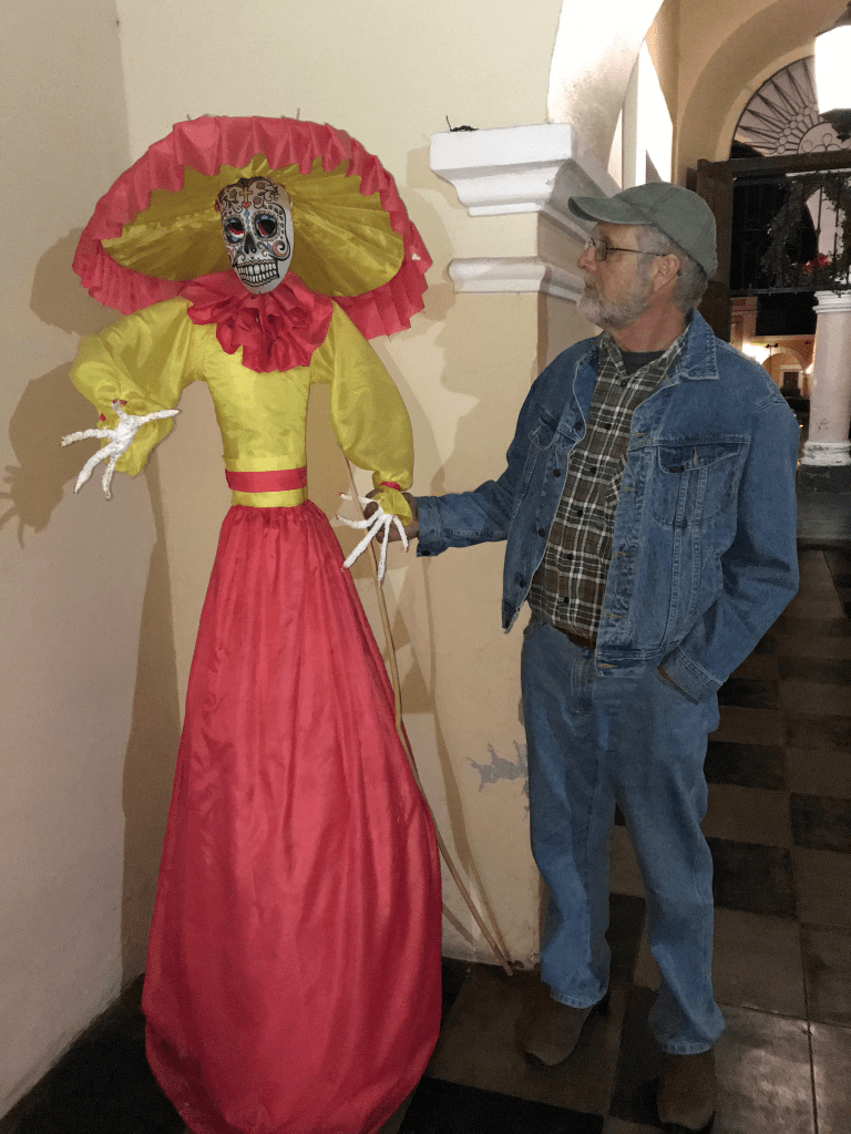
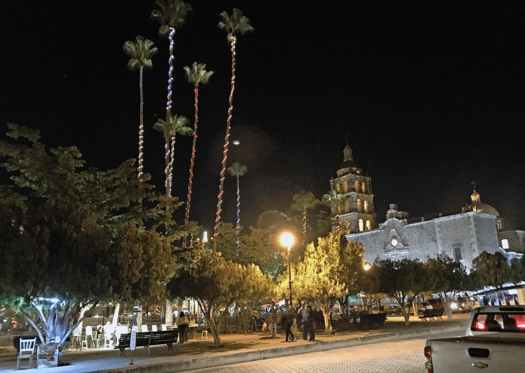
After finally checking in, we returned to the town center for a preview of the celebrated destination. An unbroken string of cars snaked between the rows of whitewashed colonial houses and past the central plaza, with its eucalyptus trees surrounding an elevated cupola. Behind the portals lining the square, vendors hawked their colorful crafts, and well-heeled tourists sat at café tables taking in the festive atmosphere. An elaborate wedding was underway in the parish church, brightly illuminated inside and out.
That night, with only our noses braving the chill air from beneath the down comforter, we agreed that repose had never felt better.

Excellent! Looking forward to more.
LikeLike
Yes, more on this corner of the desert over the coming weeks. Delighted you liked it.
LikeLike