For a very long time, most people who were even aware of the Pinacate Biosphere, knew it only as an unexceptional mound tapering down to the highway from the west, somewhere between the border and the thriving vacation town of Rocky Point – Puerto Peñasco to the Mexicans – on the mainland coast of the Gulf of California. Oversized signs announced the unpaved access leading past a single-wide mobile unit where, if anyone was on duty, they collected a fee in exchange for a typed list of park regs.
Within a couple of hours, visitors, as long as they had heavy-duty suspension, could make a tour of several dramatic features – the Elegante and Cerro Colorado craters, the dark young lavas spreading away from the Tecolote cone, and endless flats of volcanic cinder. With an extra permit, they could follow the rugged road toward the massive shield volcano and sojourn at the Red Cone campsite, visiting impressive natural catchments and lava tubes, and even make the long hike up one or both of the cinder peaks.
Early crossings
With all the natural attractions concentrated there (if “concentrated” can even apply to such a vast area), most people would see no need to venture beyond this northeastern portion of the park. And yet it is only a fraction of the 600-square-mile total.
The heaviest, most dramatic lava flows actually are on the south side of the mountain. It was across this shoulder of the mountain, now dubbed the Ives Flow, that most of the earlier expeditions passed through, probably because it kept them in sight of the sea. Father Kino’s group, marching down from Sonoita in their attempts to find the easiest way west, believed that some of the yawning lava tubes on this slope must lead all the way to the center of the earth.

Although the big craters would not be “discovered” by European types until about a century ago, all these early explorers did know from the native peoples where they could expect to find water. And Kino’s group was the first of their race to climb to the summit, their goal being to sight the confluence of the Gila and Colorado rivers.
The sterner face
For decades, only a railroad has cut across the dunes between the mountain and the sea. A few years ago, though, a two-lane highway was built between the rustic beach town of El Golfo de Santa Clara and Rocky Point – no doubt in the hope of capturing more business from the border cities of Mexicali and San Luis, and even, por Diós, from the opulent megalopoleis of Southern California.
The shoulderless pavement winds over the coastal dunes, at times appearing ready to slide into an adjacent tide pool. Frequent signs tout the ongoing biological studies and warn about the sand that drifts onto the roadway like snow. All along the drive, the looming volcano pivots against the sky to the north, the Ives Flow shining in the relentless sun.
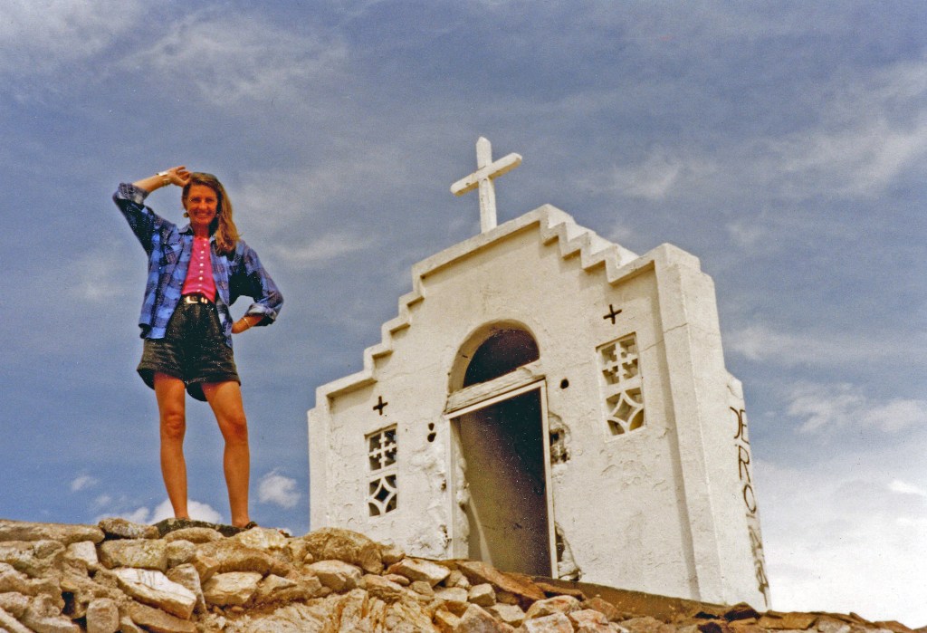
For a closer approach into this seldom-seen side of the park, a long, rugged road off of Hwy 2 curves around the mountain. During the first half-dozen years when I was a regular visitor, I always passed by this entrance, since the more easily accessed northeast side was keeping me busy. Once I had finally conquered the highest peak, though, I was ready for some variety.
A narrow window
I recall that our trigger for finally visiting the “backside” was a late cold front in June. Usually, if we were going to drive that far, we aspired to camp two nights. But, in this season of long days, we knew we had only about 24 hours before the weather flipped again, driving us off the desert floor and back to civilization.
The rutted road in off of Hwy 2 wound through a labyrinth of crude fencing – part of a still-functioning ranch, though there were no other human artifacts, and the livestock were off somewhere on the barren range.
We just made it to the edge of the Pinacate wilderness by dark and settled into a sheltered wash. A cold wind whipped the camp smoke to and fro as we enjoyed our ashy chicken and a round of backgammon by lantern light.
Each its own character
The next day, we explored three important craters that are clustered near the western hip of the range – I don’t remember in what order – all of them named for early explorers.
McDougal and Molina, situated to the west of the jeep trail, lie outside of the exposed lava beds, and an expanse of sand dunes and creosote bushes stretches far beyond, to the foot of the next range of jagged peaks.
McDougal is a perfect circle about a mile in diameter with uniform vertical walls – like Elegante, except not nearly as deep, as the sands from the west have gone a long way toward filling it up. In the early ‘70s, astronomers from the University of Arizona brought some of the Apollo astronauts here on the theory that this would be the closest terrain on earth to what they would encounter on the moon. (A group of them had settled a long-standing controversy by arguing that some of the moon’s craters are volcanic – news to me.)
Molina actually is a cloverleaf of three smaller craters of roughly equal size. They are mostly silted in, to the point that we could walk right into them on a level with the surrounding desert.
A show of force
By far, our climactic foray of the day was down the graded road that dipped and wound across a chaos of cinder hills to Sykes Crater. We parked at the base of a steep grade that we assumed to be our destination and stormed the loose gravel on foot.
At the crest, we found ourselves overlooking a fearsome pit – dark, desolate, and, like all its sisters, perfectly round. With my 10-year-old standing next to me, I felt suddenly breathless, knowing that only a couple of steps forward would send a body sliding down the grainy slope of the lip, off the sudden edge, and all the way to the distant floor.

At 700 feet, this crater is not quite as deep as the better-known Elegante, but its narrower diameter – three-quarters of a mile – makes it appear more forbidding. And, being more recently formed, it is less weathered and more sheer. In this case, too, the discoverers proclaimed that there is only one way down on foot; this time, no one disputes it.
For miles around, the apron of heaped cinders and scattered boulders bear witness to the force of the blast. Only in the desert does one see such a raw record of nature’s tumult, stripped of any softening concealment, and only in rare cases do the wounds appear so fresh.
Miles from nowhere
It would still be a couple of years before we rounded up a group to go all the way around the back of the mountain, our destination Cuervo Tanks, at the foot of the Ives Flow. As with our Devil’s Highway safari of a couple years earlier, we had our matching blue ’87 Cherokees. (Definitely a bad idea to be that far off the pavement on one set of wheels.) Because the journey would be mainly driving – many hours along a very primitive track – we left the dog at home.
Since we were entering in mid-afternoon, we made quick stops at the abovementioned craters and continued to the interior. On the left sat the shield volcano and all its varied geologic offspring; on the right stretched the open sandy plain. Somewhere below the horizon was the Sea of Cortez and, beyond, the Baja Peninsula.

No herds of Sonoran pronghorn, not surprisingly. But a gang of wild burros did trot past us going the other way, keeping a respectful distance from our lumbering vehicles.
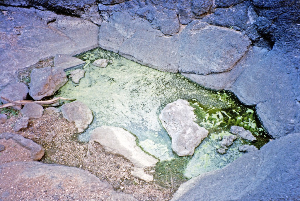
At long last, we set up camp next to the tanks but were disappointed to find them mostly depleted, the deepest of them shrunken to a puddle of green scum. This cluster, which lies at the tail end of the lavas, is shallower and more exposed than the Emilia group high on the northern slope. I also remember reading that some of the tanks have long since been drained and contaminated by the free-ranging cattle.
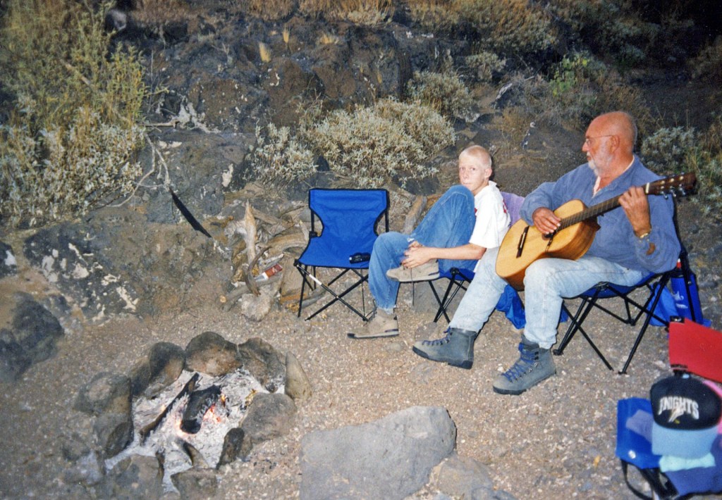
Around the campfire, we were serenaded on Spanish guitar by the newest recruit to our band of Pinacate worshippers – a fellow college professor who had grown up in the mining camps of Brazil and could warble all night without pause from one Portuguese folk song to the next without repeating himself.
A jumbled wonderland
We spent most of the following day crawling around on the multilayered flows that had run out of forward momentum here on the desert floor. We had certainly seen fresher, more jagged lava elsewhere on the premises, but we still encountered a startling variety of formations – upended segments, zigzagging chasms, smooth “pahoehoe” pavements – all of it peppered with obstinate plant species.
Once again, we were overwhelmed by the immensity of the mountain and the wilderness expanses around it. In an entire day, we were able to explore only the tiniest niche within this primordial vastness.
We also made a side trip to nearby Moon Crater, one of the smallest of its kind thereabouts. It wasn’t even identified as a maar feature until fairly recently, because one of its sides is entirely eroded away, and its floor is simply continuous with the surrounding dunes. A dainty baby crater nestles against its far wall.
Close to the edge
On the way out, we were surprised to see a ranger’s jeep bouncing its way along the rocky track, piloted by a good-natured young guy who I’m sure was equally surprised to find visitors so far in. Although he didn’t give us a hard time, he told us that technically we were supposed to check in at the main station before going anywhere in the park. We didn’t say so, but we were glad we hadn’t known, because that would have meant an extra two hours of driving.
Of course we had to take the side trip to Sykes. This time, no doubt on a histrionic impulse, I gunned the Jeep up the steep slope to the rim. At the top, though, the crater appeared with unexpected suddenness, and I swerved to a halt, my machismo palpably deflated. I picture an alternate reality in which we were found years later upside down at the bottom, a la Thelma and Louise.
Don’t sit cryin’
This was all 20 years ago and, as I recall, the last time I would enter the Pinacate preserve. I know I have been only one of the countless creatures to be nurtured at her rocky breast but, even if I’m never privileged to return, I insist upon being counted among the grateful ones. Occasionally, I still do have the immeasurable pleasure of contemplating the profile of the great shield as we head along the quietude of Hwy 3, seeking the amenities of Rocky Point.
Quite probably, such a barren expanse is many people’s idea of the Inferno, the very domain of the devil. In my case, for years there was no place I would rather be. This was all the best of the austere desert region where I had found myself, all packed within a single protected perimeter.
As the man said, love the place you’re in.
