We finally made our pilgrimage to Joshua Tree National Park the way most good things happen – quite by accident.
We got word last April that Mom was starting to have trouble keeping up her earth-sheltered house up in rural Wisconsin, so I would have to fly up and check into the situation. On three days’ notice, a marathon session on Expedia.com turned up one affordable itinerary, outbound from Las Vegas. So we stuffed our camping gear and a load of mesquite into the Jeep and headed out on an odyssey across the Mojave Desert.
The shortest route from Yuma to the south entrance of Joshua Tree is along the Salton Sea, so we followed the north shore and took the scenic shortcut east from Mecca through the Orocopa Mountains. From I-10 we made the eight-mile pull up to the Cottonwood Visitor Center and continued another 30 miles through the sweeping creosote valleys and cholla forests of Pinto Basin.
It was well past sunset when we got to Belle Campground, nestled among some blond granite outcroppings. A once-around the gravel road told us that the park was pretty full even at mid-week. At the far end of the campground, we were flagged down by a jolly bear of a guy named Steve.
Steve obviously led a life of the road, with his compact camper set on poles and his nondescript mutt, Molly, sporting a worn bandana. He mentally cataloged us among the million or so tenderfeet he’d encountered in his wanderings, and directed us back to the only open campsite on the grounds.
A mesquite fire never felt so good as on that chilly night, with the Milky Way inching overhead in the gap between our two rock walls.
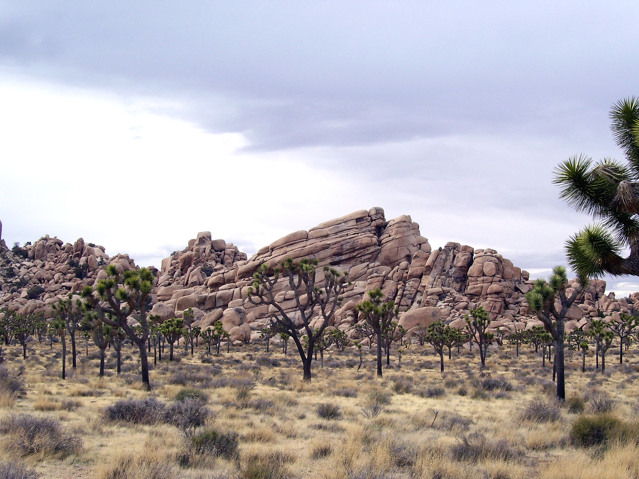
A view from above
At daybreak we woke to the nervous chatter of rock-climbing students, huddled near the granite dome across the road. By the time we set out on our tour of the plateau, they had set their ropes and were struggling with their maiden ascent.
Immediately on turning west into the heart of the park, we were among many more of the granite jumbles, formed when, over millions of years, the loose layer of gneiss (that’s “nice”) eroded away and exposed them to the sky.
Our first stop was the Ryan Peak trailhead, where we parked and started up the well-groomed switchbacks – around one hill, up to a long ridge, and finally up among the scrubby trees to the cleared spot on top, where a group of Japanese tourists had congregated. For the pristine view that stretched in all directions we could thank one Minerva Hamilton Hoyt, the California socialite who pestered President Franklin D. Roosevelt to protect almost a million acres here in 1936.
We found another high outcropping of varnished rock, where we could enjoy – in the midst of a siege of persistent squirrels – our picnic of cheese, crackers and smoked oysters while using our park map to ID the various features around us. Slanting below us to the south was the ridge that separated the Sonoran Desert from the Mojave; to the west were the snowcaps of Big Bear.
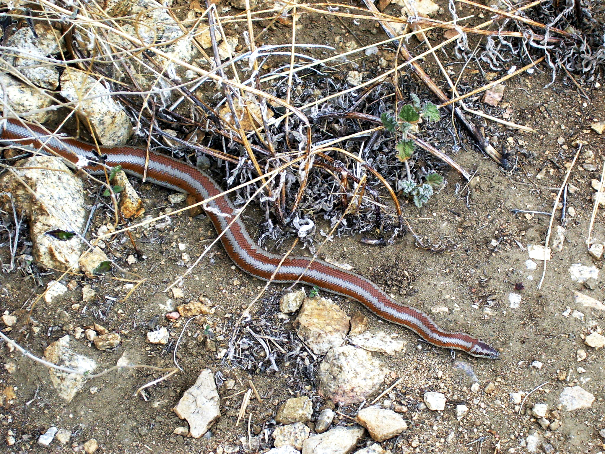
But at 5,500 feet the wind was gusty and cold, and we soon headed back to the desert floor. On the way down, we had to step over a brown-striped snake draped across the trail, just beginning to loosen up in the spring sun. In all, it was a three-mile hike, though it seemed much longer with a five-year-old.
A view through the haze
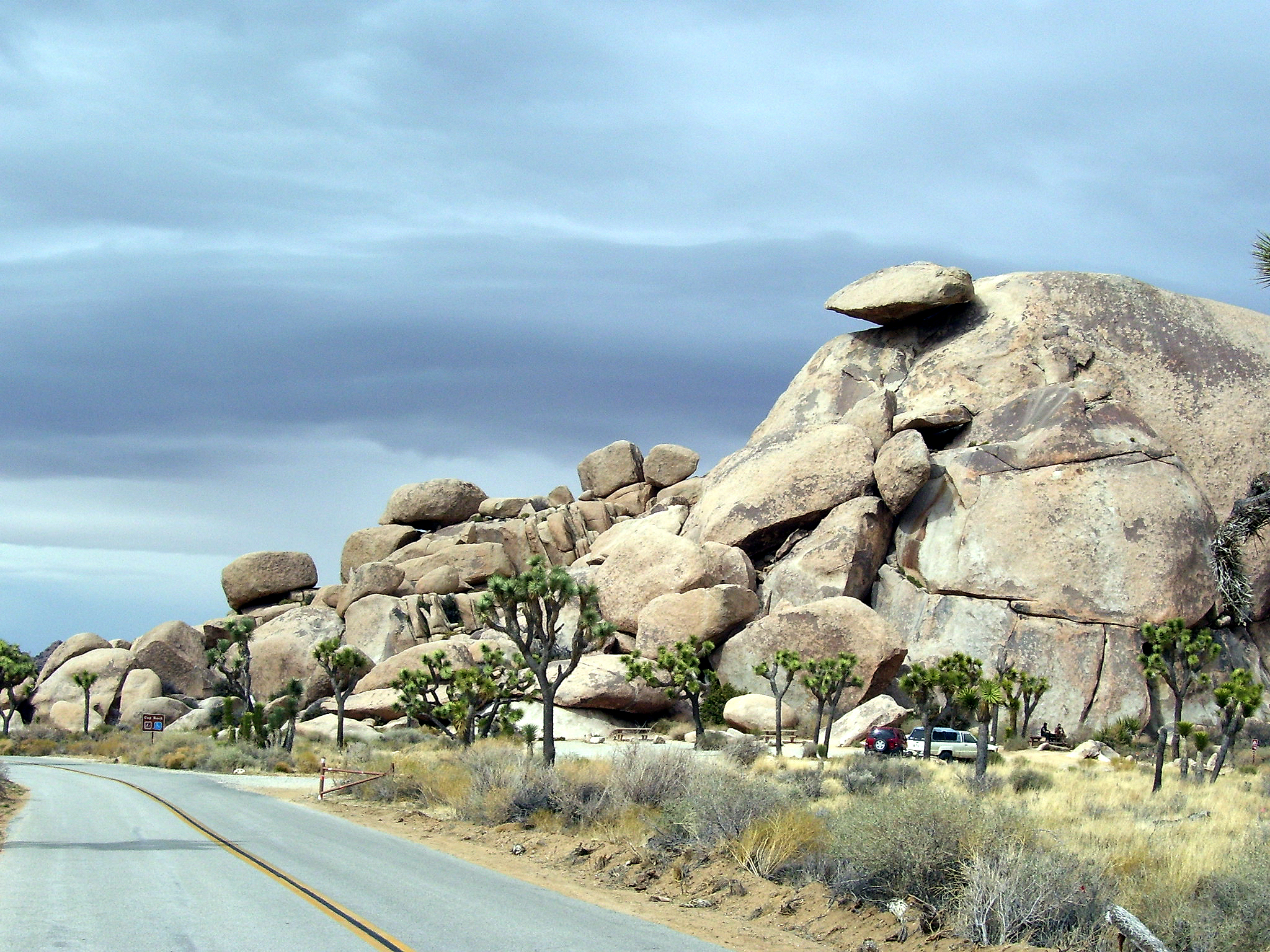
Next on the itinerary was a jog south, onto the five-mile road that dead-ends at Keys View. Right near the intersection is Cap Rock, a huge spherical monolith topped by a delicately balanced visor-like slab.
Along this stretch of road is probably the densest forestation of the Park’s sublime namesake plant, the Yucca brevifolia, a giant member of the lily family. The Joshua tree is an essential part of the desert ecosystem, providing habitat for a variety of mammals, birds, reptiles and insects, including the yucca moth, on which it depends for germination of its seed. The largest tree in the park, a whopping 40-footer in the Queen Valley forest, is estimated at nearly 1,000 years old.
Keys View is a breezy overlook perched on the southern rampart of the plateau, dropping off into a network of dizzy ravines. According to the signs, you once could see to Mexico from here, but floods of brown smog from L.A. and the activities of the Coachella Valley population – 100,000 and counting – has rendered visibility marginal and occasional.
We were blessed with a relatively clear day. Off to the left we could see a corner of the Salton Sea through the haze. Straight ahead was Palm Springs, nestled against the towering San Jacinto Mountains. And to the right we could make out the proliferating windmill forests in San Gorgonio Pass.
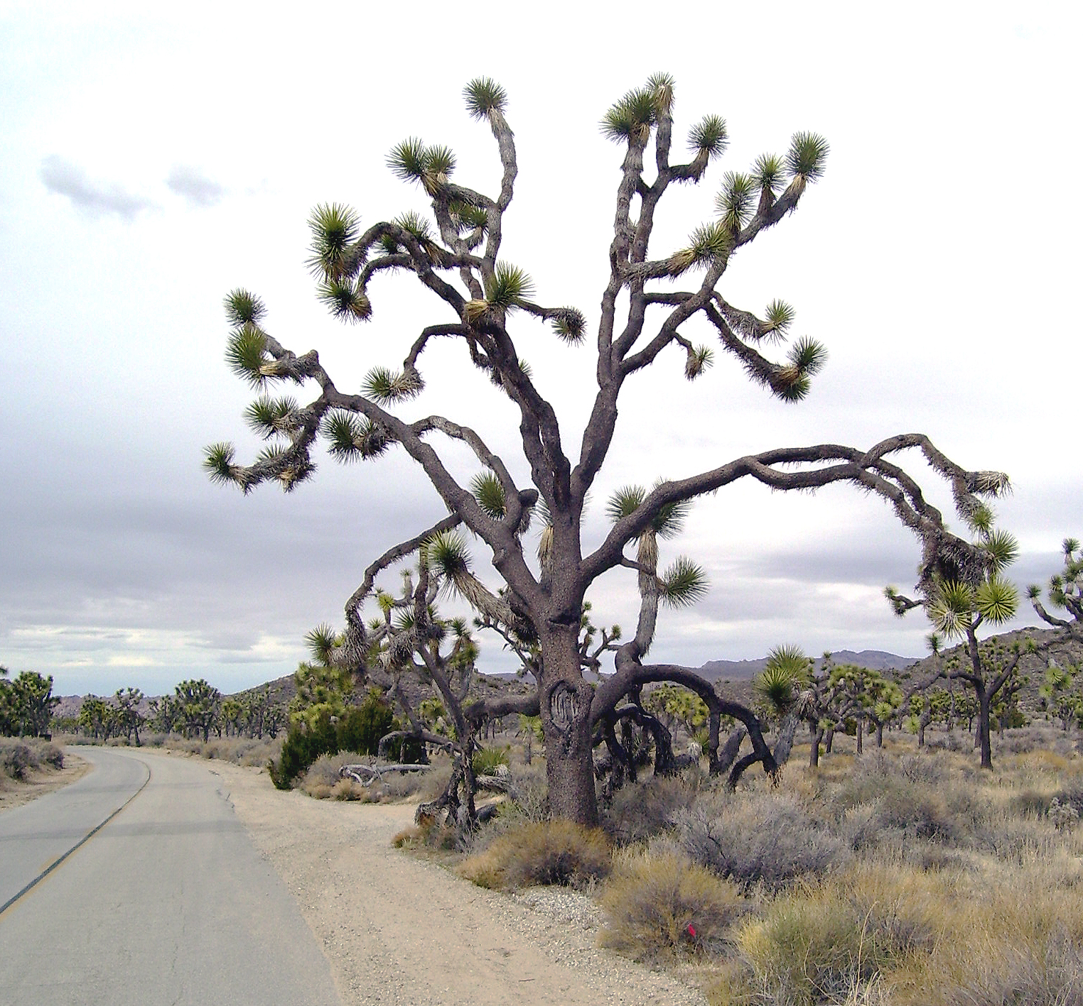
On the way back down from Keys, we pulled over to admire a soaring octopus-like tree – probably not the one in which the 19th-century Mormons had pictured the wilderness prophet.
A view through the lens
Our next detour was into Hidden Valley campground, which loops endlessly among rock jumbles. It’s an awesome formation, with lots of opportunities for climbers. But the campsites generally are squeezed in just a few feet apart, from one fissure to the next. We ambled along, silently grateful for our sweet little spot back at Belle.
From there we followed the northern loop, past Barker Dam and in among the old mining claims of Queen Valley, where a few stone walls still stand as testaments to the long-defunct operations.
That night, as the mesquite logs crumbled into gorgeous coals in the fire pit, we got the idea to invite Steve and Molly to share our overabundance of barbequed chicken. And later, after the dinner debris was cleared away and the girls had curled up in the tent, Steve and I stayed up talking.
The blotchy swelling in his legs, he said, was from an infection following the rare bite of a conenose beetle. But his more fundamental trauma – he offered a little farther into the bottle of Imperial Valley wine – went back to his three tours of duty as a dog-handler in the jungles of Vietnam. I remember thinking that he’d earned those psychological disability checks with which he financed his migrations from one National Park to the next.
The next morning as we were packing up, Steve came by once more as promised, to show us the photo albums he’d compiled from Joshua Tree over the years. It was a stunning collection of nature photography, the product of top-notch gear and the patience of someone who finds the pace of modern life painful.
Somehow, he had been able to get shots of a bobcat devouring a jackrabbit. But his crowning sequence was of an eagle’s nest he had climbed to near the natural water catchments out in the rugged hills toward the south. He told us how he had hiked back every day for a month, waiting for the eggs to hatch. Finally, the Ranger had confronted him for overstaying the two-week limit, but he had begged to stay one more day. That day – before he was escorted to the Park entrance – he photographed the mother eagle flying in with a live rattlesnake to feed the three new hatchlings.
A view of infinity
As we were leaving, Steve told us of his special spot – sacred to the Native Americans – down a little-known jeep trail, where he had scattered his father’s ashes. But that would have to wait for next year; we had one more day-trip on the agenda – the Geology Tour into the southern reaches of the Park. Here we would see a more familiar landscape, with dark basaltic intrusions and the classic Sonoran Desert creosote, and even some ancient artifacts – a few petroglyphs, and some grain-grinding metatesscattered along a chain of natural water catchments.
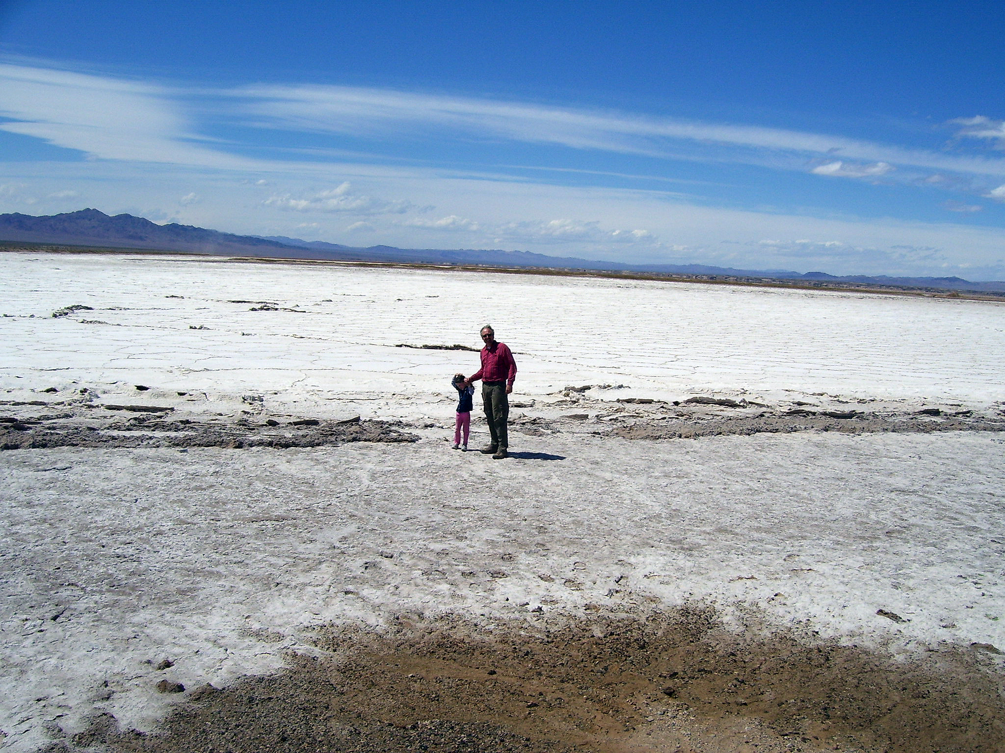
The cool spell had ended, and the sky was taking on its summer glare. We exited the Park at Twenty-Nine Palms, where we loaded up on souvenirs at the very enlightening Visitor Center. From there, we pushed north across the sweeping valleys and ranges of the Mojave moonscape – past the salt flats of Bristol Lake and the soaring dunes of the Devil’s Playground, which dwarfs our own Algodones strip.
Finally, in the middle of the Mojave National Preserve, we found our biggest thrill – a forest of Joshua trees much thicker and vaster than the one back at the National Park, with only an occasional traveler and the deserted shacks of Cima to contemplate it.
