For about a month now, we had been devoting our weekends to the search for native art along an area known as the Great Bend of the Gila, stretching in a long ess-curve along the river valley within the southwestern quadrant of Maricopa County. Behind us lay about a 30-mile stretch from the Yuma County line to Gila Bend, ahead of us a roughly an equal stretch up to Hwy 85 at Buckeye.
In our wanderings, we had been rewarded with not only inspirational traces of a once-thriving civilization but also breathtaking glimpses of one of the most starkly beautiful landscapes on the continent – all of which lies at the margins of the agricultural corridor, put to intensive use over the past couple of centuries by the descendants of migrating Europeans.
Pests in perspective
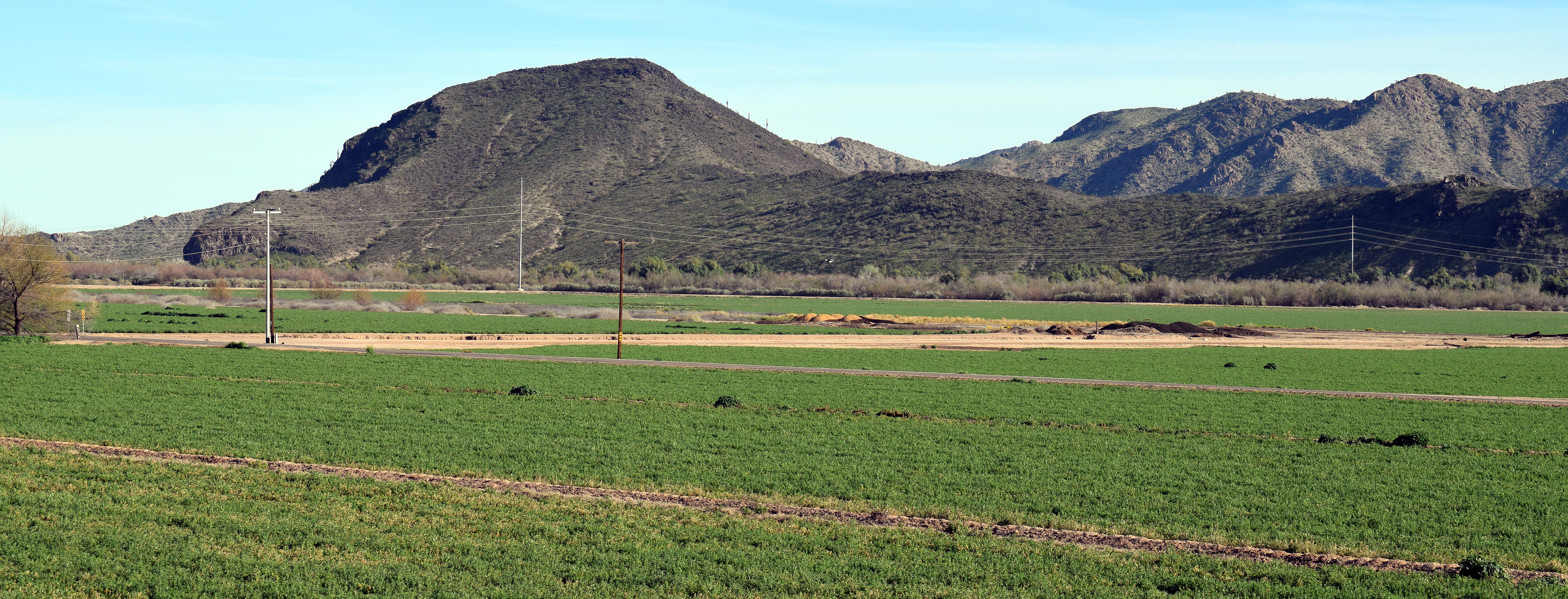
From Old Hwy 80, the approach to the eastern edge of the Gila Bend Mountains leads across the floodplain carpeted by year-round cropland. The first major drainage north from town is Red Rock Canyon, named for the exposed sandstone hip at its mouth.

A well-maintained graded road took us back into the pocket, eventually ending at a hidden farm. Our trail map showed a two-mile hike across the rugged plain, but we could see a vehicle moving slowly much farther in, so we set out in search of that jeep track.
Presently, we passed the mud-spattered Rhino coming out, driven by a couple of talkative hunters who had come up empty-handed in a predator-hunting contest that would award them specified points for bagging coyotes, bobcats or foxes. We decided we would just have to trust the regulating agencies in their greater wisdom concerning the optimum concentration of predators that have survived in this wilderness after several decades of severe drought.

We spent a couple of hours searching among eroded overhangs for traces of earlier human inhabitants. It turned out that the art itself is very limited here, although its presence on the fragile sandstone some distance from the riverbed makes it unique in this area.
Ancient art, modern ruins
During the workweek, the fields are no doubt crawling with specialized ag machinery, but on Sundays there’s scarcely any motion or sound. Even Old 80 was essentially deserted all the way to where it passes through a dark volcanic neck at Gillespie Dam.

Just before the road crosses the river sits a tiny parking lot for visitors to the historical marker commemorating the narrow steel-truss bridge, which, when it opened in 1927, was the longest highway span in the state. Across the road are a couple of huge pipes dumping the last of the open water of the Gila into canals that sustain the farming downstream.
There, below the roadway, was the usual gathering of locals who come to fish from the levee in full view of the broken concrete dam, a simple spillover construction that failed during the record runoff in early 1993 – the same year when levees in the Wellton Valley near Yuma were breached, flooding many acres of farmland there.
The archeological zone includes the cliffs above the dam, blackened by layers of desert varnish. Here at this geological feature – where lava flows halted the westward progress of the river, diverting it to the south – are some of the most spectacular petroglyph panels in the area, including some unique images such as a woman giving birth. Some unfortunate degradation has taken place, however, due to the lack of active protection.
Public vs. private
Leading north from the dam, the highway dips among more fields. Behind them are the shrub-choked riverbed and, beyond, the crumbling granite of Buckeye Hills.

Up ahead we could see the low black line of Arlington Mesa. The petroglyphs on the edge of this ancient lava flow are on private land, but we still hoped to catch a few glimpses from below, so we hopped up onto a narrow, rugged levee road alongside a canal. Many of the “painted” rocks have by now tumbled down the slope, but our improving intuition helped us to spot a few subtle clusters.
From there, our destination was Powers Butte, directly across the riverbed. We weren’t optimistic about being able to cross at this point, but of course we had to try. Indeed, the dirt road we followed eventually ended in deep sand among the inevitable thickets. One side track took us past a group of young city guys blasting handguns against a semi-permanent bank of targets they had set up there on public land.
Flowing water
As expected, we had to drive all the way east to Hwy 85, across the concrete bridge, greatly upgraded since the 1993 flooding, and west into the Robbins Butte Wildlife Area.
We were hoping that, when we were done here, we would be able to follow this same road to the south and come out near Gillespie Dam, so we queried a group of campers, their caged hunting dogs scattered among high-end RVs. But they were from out of state and were only in the area for a canine-performance competition.
In the absence of any hiking trail, we didn’t reach the ridge of Powers Butte until after sundown. Far below, at the foot of the cliff among the dense trees, the main channel was filled with water after recent rains on the desert floor and snows higher up on the Mogollon Rim. So much for there being any way to drive across the river.
Into the distance lay the twinkling lights of the central valley, and at our feet was an undisturbed rock jumble with yet another unique style of pictures and symbols, reverently crafted by our ancient forerunners in these wild environs.
Revering the landscape
Maybe no one really knows anymore what this ancient art was originally meant to communicate. In fact, the act of painstakingly inscribing living creatures and meaningful symbols onto exposed rock implies a relationship with the natural environment that we can no longer fully understand. It seems to say that everything, even the ground beneath our feet, possesses life and awareness.
Three years ago, a study on the subject, “The Great Bend of the Gila: A Nationally Significant Cultural Landscape,” was published by Archeology Southwest on behalf of the National Trust for Historic Preservation. In the Forward, cultural officers of the nearby native peoples mention “an ancient cultural landscape that speaks to a deep history of multiculturalism in one of the most challenging environments on earth” and, in another passage, “traditional and spiritual understanding of, and respect for, the natural resources and vast ecosystem.”
Our own modern culture should be so enlightened as to possess that kind of understanding.
